Sunday 3 February 2013

The Road to Kisoro - The Batwa of Mgahinga


I woke up the day after with a stonker of a headache. I simply didn't realise how dehydrated I was from the epic descent. Armed with a big bottle of water, we left at around 8am. The drive would take us right across the Queen Elizabeth National Park (is it surely beyond the motivation of the Ugandan government to keep naming one of their most important national parks after a monarch from their colonial past ?!) on a very smooth tarmac road. The conditions of the principal roads have impressed me much more than their naming of national parks. This national park is mostly a vast savannah. We didn't see any animals at all as far as the horizon and none attempted to cross the road. As midday approaches the temperatures rise and so most seek shelter from the sun. Traffic was light, which was not surprising for a Saturday morning, and the drive was pleasant despite my throbbing head. We crossed a major channel that connects Lake George in the interior of the national park to Lake Edward (that Uganda shares with the DR of Congo) before climbing the eastern side of the Albertine Rift and then heading out of the national park. A significant section of the route was murram as there were some major road projects going on between Ntungamo, in the Ankole region, (the birthplace of the current president Yoweri Museveni) and Kabale.


The journey through Southwest Uganda culminates at the triple point of DR Congo, Rwanda and Uganda (Courtesy of Ezilon)


The landscape became more hilly, prominent with smooth mounds of extinct volcanoes that were now grazing lands, suiting the pastoral lifestyle of the Ankole people. We stopped by Kabale to get money and see about some lunch. It was now midday and pretty much rush hour at the cash point. The usual fiddling for maximum withdrawals by us foreigners was drawing gestures of impatience from locals queueing behind us. It was still too early to order lunch here so we got some chapatis and pre-ordered food at the Golden Monkey restaurant in Kisoro, at Ema's suggestion. The approach to the Virunga volcanic region is quite a treat. The grazing lands now became farm lands, neatly terraced around the rolling hills with a quilted blanket effect. The new Kabale - Kisoro road was impeccably smooth though some of the reinforcements on the cut hillsides looked quite weak and possibly prone to landslides during the future rainy seasons..  In one long view, Lake Bunyonyi was just as magnificent as its meaning (''place of many little birds''), as if a body of water suddenly flooded the hill cluster, creating islands and a vast shoreline.


Stunning sunset over Lake Bunyonyi (Courtesy of Africa Geographic)


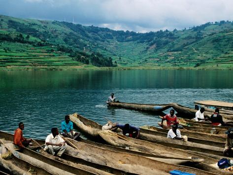
Market day on the lake in dugout canoes (Courtesy of All Posters Images)


We arrived in Kisoro. The goat stew that we ordered was somehow transformed into a beef stew. Nothing is ever certain when it comes to restaurants in Uganda, based on our experience. The stew was very tasty nonetheless! We had booked to stay at the Amajambere Community Camp right at the gate to Mgahinga National Park, that harbours 3 great mountains, Muhabura, Sabinyo (both extinct volcanoes, and Gahinga (a dormant volcano). It also has a gorilla group that had recently returned, as the story goes, from Rwanda after a debacle with a big silver-back bully. There was a mix up with the booking at the camp. It seemed that our booking never arrived at the camp! Some frantic phone calls later, under some rather inconvenient afternoon rains,  we had to concede to stay in a dormitory, not the planned individual banda. We were appeased (at least I was) by a fantastic chicken and chips dinner (the best I've ever had in Uganda...believe me we ate a lot of chicken and chips out here!) and some really pleasant dorm mates.


Sabinyo in the Kinyarwanda language means ''Tooth''. 


That night, one of the camp managers introduced himself and the community activities that they organise. This includes a tour of the Batwa community and their activities. I had read a bit about their plight since their displacement from Mgahinga National Park after it got gazetted. The Batwa people are part of an extensive group, called Twa, across central Africa, known for their hunter gathering lifestyle in the tropical rainforests. Their average short height and consistent traditional way of life triggers puzzlement and often derogatory attitudes from communities around them and indeed the anthropologists who attempted to chronicle their origins and culture. It has thus added negative connotations such as the word ''pygmy''.

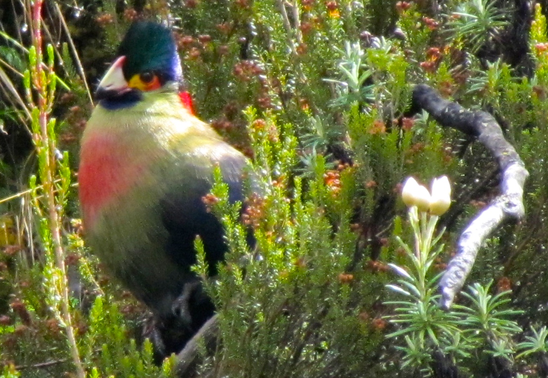
Most tragically in 1992, this area was gazetted by the government as ''The Mgahinga Gorilla National Park'' and was listed as a UNESCO World Heritage Site to protect the 350 endangered mountain gorillas within its boundaries. You need to think again about the meaning of heritage and the role of national and global organisations in shoving out people, who have been stewards of this habitat for hundreds of years, and paradoxically naming the area after gorillas instead of the people that have been respecting and protecting their environment all along. Such a move, in my opinion, suits conservation tourism as an exploitative industry rather as a dual leisurely and educational activity. 

Their current state is quite pathetic, deprived of their traditional livelihood and thrust into a semi-modern, conservative, agrarian society and most who couldn't adapt resorted to begging and succumbed to alcoholism. Quite cynically, the camp manager mentioned that it is best to visit the local Batwa community before 9 am as most men would be too inebriated by 11 am. His reference to ''these Batwa''  didn't give me much confidence that they are being treated as equals amongst other communities. It put me off doing the community tours of the Batwa homes (Jason was put off all Batwa related activities altogether!).

I wasn't sure if I would do any tours in the park this morning as my feet were still in pain and blister ridden. I was determined to at least slide towards the park visitor centre to see what goes on there. After squeezing my mangled feet into the trekking boots, there was a better feeling of confidence in my feet. As I had breakfast I decided there and then to do something. At 9 am I headed towards the park gates. I asked the rangers assembled at the gate about the various excursions. I was then directed to the visitor's centre, an elaborate building with information displays and a mini auditorium whose construction was heavily funded by foreign donors. Ironically, there was actually no UWA staff on duty on my arrival but 2 people also looking to get on an excursion.

I was noticing a trend of being notified of the importance of punctual arrival to trips only to spend an hour hanging around before anything actually takes off. One ranger, in military police-like uniform, turned up but just seemed to hang around. Finally someone in charge turned up with other colleagues and we, the 3 tourists, discussed our preferences with them.  They looked at my trekking boots and announced that I needed to hire rubber boots since it rained a lot the night before. I said that I wanted to do the excursion that needed the least amount of walking. The Batwa ''Pygmy'' Trail was the best, they said, so I reluctantly accepted it. It turned out that the other 2 were also interested in the Batwa Trail. They both were volunteering with an organisation contracted by the UNHCR to provide medical services to the refugees from DR Congo who are being sheltered at a camp just outside Kisoro Town. Mark is from Alaska, USA and Mary from Alberta, Canada. We assembled in the mini auditorium for a briefing. About 7 people turned up: 5 Batwa men in traditional attire, one UWA ranger and a UWA guard / tourist police officer with an enormous rifle.  I didn't catch all the names but remember that the UWA ranger was called Luke and the Batwa leader had a name that approximated to Daudi.

The presentation clearly announced that the UWA were representing the Batwa and were to transmit our questions to them. Luke mentioned that Daudi understood English but couldn't articulate himself in the same language. To what extent this was true was less important than the unfortunate fact that we could not have frank and direct discussions on the current Batwa situation. It was to be a well orchestrated, almost stage managed, trail with Luke towing the official UWA line. So we hit the trail starting by witnessing a Batwa ritual gratitude to God for all the bounty that exists within the forest. It is completed with a tap of the forehead on a branch. I too tapped my forehead on it just to go with the flow and as a mark of respect, something that I suspect is not well distributed around here.

A couple of metres down the trail, one of the Batwa men got out a dagger and started digging out earth under a bush. Luke explained that they were extracting wild honey from stingless bees - how I have never heard of such a convenient method of honey extraction I have no idea! First, a hive of bees, then a hive of honey. The hive has a curious leaf like structure, completely different to the hexagon matrix of stinging beehives. By the way, it is not as yet possible to domesticate these bees for commercial honey production. I had a taste of the honey, which was dark with a consistent viscosity and pleasant, sweet, musky taste.


Harvesting wild honey


Extracting the wild honey


On a nearby stream another Batwa man pulled out a bunch of thick, wide bamboo sticks and collected water. They are naturally segmented and so water cannot leak downwards. The top was bunged with a clump of grass. We also learnt that both fresh and cooked food can be stored in these sticks for days when the hunt is long and food is not readily available. Now, the main reason that we had a guard with a rifle is to protect us from buffalo attacks in case we came across a herd. They usually are easily startled and resort to aggression if fleeing is not an option. Forest buffaloes are smaller but more aggressive than their savannah cousins. The guard normally fires in the air to scare them off. Buffaloes are part of the conservation equation, so shooting to kill is normally unthinkable.

We spotted some buffalo footprints and by now I could distinguish the two-toed hoof marks from others. Also some buffalo faeces, very strandy from the grass fibre but wet indicating that they are fresh and that a herd moved through just a few hours before. The Batwa now did a dance of joy and gratitude before the hunt. To me, this was a sorrowful number as they cannot truly hunt under the current circumstances. There was supposed to be an introduction to Batwa hunt techniques in this clearing but the guard spotted buffalo movement so we had to move to higher ground as he cocked his rifle. You could hear the snorting of the irate buffalo. The forest buffalo have an interesting tactic of retreat and ambush. Because of their poor eyesight they are not at ease at close quarters. Their reaction is to flee into hiding and then attack when confident of their retreat position and scent of the "enemy". The guard fired his weapon upwards to make sure that no such thing happens. On the trail, as with any (which was self-evident in the Rwenzori!), one has to be mindful of what they step on. Red ants normally cross footpaths on their superhighways between anthills and their resources, so one has to be careful not to become a vertical superhighway and get stung at the bottlenecks! One of the Batwa demonstrated one type of vine that they use to make belts through a process of stripping, drying and binding. I observed later that they also use them to bind bamboo beams together for structures.


Making belts out of vines


We had a break at a rest hut that was listing. This is because an elephant one day decided to rest on it and even knocked out the centre support pole! We had been walking through the secondary rainforest upto now - this is the contentious gazetted part that resulted in the displacement of people from 1991 not long after the conclusion of the Ugandan civil war. Now were entering the bamboo zone. This is a favourite area for the Batwas to build semi-permanent structures across the undergrowth and preferably in a clearing within the bamboo forest. We were shown one example of it but obviously it was just a museum piece of no current function. It has a high bed with straw and animal skins as padding and sheets respectively. This is for the man and woman. The children sleep on mats, with animal skins, on the floor and near the entrance. It may seems reckless, since wild animals are likely to wander in but one usually places sharp stakes planted to the ground within and pointing outwards. I was not fully convinced of this setup as snakes and other dangerous animals could still slither in. Usually, for the Batwa, one becomes an adult at the age of 15 and moves into their own hut. We were shown a treehouse, mostly made of bamboo, where children can stay whilst men are hunting and women doing gathering activities. This prevents them from getting attacked by animals and it is also a double-edged sword: they can practice shooting at prey with bows, arrows and spears if any suitable animals comes within their range.


Photo opportunity at the rest hut


Sentinel at the tree-safe-house


The Batwa men now taught us how they make a fire. This involves 2 sticks: one with several slots etched along the length, one with a hollowed end and a sharp wooden pick nailed inside. The stick with the pick end is repeatedly spun, at the pick end, on one of the slots. The friction create saw dust. It is the saw dust that starts smouldering before creating a faint glow. The men normally immediately place dried twigs to kick start a full fire. In this case, to my confusion, they chose to light a cigarette! Mike exclaimed that he hoped that they aren't picking up this bad habit. I suspected that tobacco smoking might not be a traditional Batwa pastime, and certainly not the commercial sort. We got some nervous smiles as responses then we pressed on. Also within the same vicinity was a miniature, even by the diminutive Batwa scale, shrine where they pray to their spiritual deity. These prayers are usually led by the group leader but I understood that not much of that is practiced anymore since the gazetting of the park, or rather deportation of the Batwa.  A short while later, we were shown a special leaf that the Batwa use before hunting to help calm the nerves. It literally  lowers your blood pressure. Luke commented that it is like chocolate for the Batwa people, in other words a delicacy. This was obviously a comment for western touristic digestion. As I cringed, I realised that there is a  certain degree of truth in the sense that chocolate does have medicinal qualities though I didn't test the flavour of this particular leaf. We returned into the secondary rainforest, still in the direction of the trail, moving up a hill.


Making a fire


Mt. Sabinyo was in full view but with its peak under cloud cover. Finally we found a safe spot to witness the hunting simulation, to highlight the day's simulations! One Batwa man played the role of an animal whilst the rest were the hunters. I could describe it as best an educational farce. Both educational and farcical, which sadly lowered the dignity of the Batwa people further still in this reduced view of Batwa culture.  On we go, another interesting sight - stone-like spheres hanging from a tree - wild pumpkins. They are actually not edible for humans but elephants love them when unripe, and then gorillas covet them when ripe. They do have a use for humans though. Batwa children have been using them to make dolls and also imitate the herding boys of other communities, pretending that the pumpkins are animals. Once again, this is an UWA translation and unless there is means to communicate directly with knowledgeable Batwas, it is hard to tell how small the pinch salt that I take shall be. The Batwa demonstrated several plants used from life to death, especially during times of mourning a loss. One is for strength and the other for invincibility. I was beginning to imagine the psychedelic effects of these herbs. Mary, the Canadian, even more curious on this matter wondered about which of these plants have been tested in a lab.

The penultimate part of the trail was the Batwa cave - the Garama Cave. There is a legend behind this cave, created after the solidification of a series of lava flows thousands of years ago. There is fabled to have been a Batwa king who resided within this cave and held court there. He apparently would direct the affairs of the community from there including raiding other communities for food and weapons, which were stored in one of the caverns. The ceiling is low and varies as you go along, so you have to make sure that you don't graze your head on the ceiling. The end of the show featured a Batwa women's chorus group already assembled within the King's den. They then proceeded out of the cave with us remaining inside the Batwa grotto ride of Disneyland Uganda. We saw them again in an opening that on a clear day gives great views across to Eastern DR Congo.


The last dance, hopefully not forever


Also check out the The Batwa Trail Photo Album here.

July 21st 2015And.....how uncanny! Vice News did an article this year on the plight of the Batwa, taking the same exact photo of the Batwa man in the tree house with a bow and arrow. Check it out here.

Thursday 31 January 2013

The Rwenzori Journey - The Descent - Day 7 and 8


Rapid descent is normally the order of the day on the penultimate day. I did fall into a deep sleep but was interrupted by the need to go to the loo (finally rehydrated!) and simultaneously my annoying phone alarm from the night before (for the final ascent) that was set to go off at 3 a.m.! It was a crowded cabin that night , full of exhausted trekkers (some descending, some ascending to and from Mt. Stanley and Mt. Baker) so I'm sure the alarm didn't bother anybody though it was quite a challenge locating the darn phone in the mangled pile of trekking clothing and gear, whilst catching a deathly whiff of my neighbours trekking socks. Ugh.


Hunwick's Camp - As seen from its toilet. In the foreground, the slippery gang walk of death 


My appetite was improved and I was able to put away the pancake slowly but surely.  The departure from Hunwick's Camp was rather chaotic with the muddle of groggy trekkers moving about the cabin, with their stuff all over the place, and I almost left my torch behind. Mutanda Camp (The Rock) is the usual destination but in order for me to recover better, Richard suggested that we focus on crossing the Bamwanjara Pass and just make it to Bugata Camp. My pace today was good and I could keep up with most of the others. I was tanked up on water and carbohydrates, enough to go up the big daunting pass.

We left nice and early in order to beat the lunchtime rains. I had to use my trekking pole more efficiently and to maintain a constant walking rhythm. I made good progress up the muddy end of the pass. James and Richard were already at the top. The rest of us landed at the top of the pass, comfortable in the knowledge that the camp was less than 2 hours away. Clouds were coming in with earnest.  We wolfed down our tuna sandwiches. It makes me wonder how I can be motivated to go on a demanding expedition like this without a catering team with me to feed my demanding appetite with such consistency.


 Looking back at the overcast Mt. Baker 


My energy was restored, and we dropped back into the lake valley, with Lake Africa emerging between the ridges. It was threatening to drizzle but we were spared by the time we hit camp. It was 3 p.m. and I immediately proceeded to switch from sweaty to drier clothes, enter the cozy dining area, hop into my sleeping bag and monopolise the mattress in the corner. I needed to warm the thing up for almost half an hour as it really feel colder here than up at Margherita Camp. It is the most exposed camp, facing all the winds funnelling through the valley which probably explains it. The lads were at it with their journals.

After dinner of mushroom soup, vegetable stew and spaghetti, Richard and Abel came in for a final debrief and feedback session.  It was quite a frank exchange and they emphasised that we should offer any criticisms and discuss our tipping strategy. My big comment was that I expected a challenge and got a challenge. There was some commotion near the door. Richard, clearly irritated asked: '' Who is it? We do not want to be disturbed!''. It was Green, one of our porters who was the youngest, fastest and probably a top candidate for a future guide role. Richard's future understudy responded enigmatically: ''I am the one''.


Overcast and wet, because the everlasting flowers have closed in their petals 


There was an almighty downpour all night which made the prospects of a complete descent very daunting. We needed to rise early and slipping into rain gear that was already wet was not pleasant. Green made a valiant effort the night before to wash and dry some of our clothes. It was still raining when we left at around 8 am, later than planned. The team officially split with now Richard, James Green and 2 other porters going on a different route that would complete a 9 day trek tomorrow. As predicted the grand swampy valley was soaked out, and my inner waterproofs were beginning to do their work. It takes a lot of concentration to identify the semi-submerged tussock grass to hop on.

On one puddle, water was flowing upwards. Abel commented that there is a sink hole there. If one stepped on it, he/she would be drawn in. For a split second, I wondered whether this hole is visible when dry since we had used this path on the way up! There were more hazards to worry about. We somehow emerged into the plateau of endless grass and streams. Boots were still a must and indispensable here. Streams that were gentle during our ascent were now gushing and new waterfalls were now raging as if out of nowhere. My spirits were higher now. I was warmed up and my body seemingly forgot about the damp conditions. The terrain was still flat all through this plateau and we bypassed our detour point during the ascent, where we had lunch.


At rare break of sunlight on day of the descent (Courtesy of J. Chow)


Within 2 hours of our departure that morning we were back into the dead tree zone near the ghastly Mutanda Camp where roots, stumps, and rocks, all wet, added new hazards. The real downhill challenge had just began. We met some trekkers on their way up. They had just left the Mutanda Camp. I did my best to say the most positive things to them but my comment ''it gets better as you go up'' may not have been too reassuring. Our route avoided the camp itself and we proceeded directly into the giant heather and moss zone, where my backside became well acquainted with a particularly smooth rock face by a stream a couple of days ago. I began to wish I had gators (waterproof ankle and shin wraps)  as I was beginning to feel discomfort of wet and sandy socks within my rubber boots. My left big toe that had been taking many a pounding was not hurting, but was still bruised and ridden with blisters. I changed my footfall, which proved to be fateful.

We had lunch at the same lunch site of the Day 2 lunch break, and continued quickly as we were weary of lost time. The idea was to reach the Kilembe Hostel, out of the national park, by dusk. Our porters, Jamie and Cyril, had started after us but caught up with us well before the  giant heather zone. I began to really suffer after lunch. The new left footfall was straining some foot muscles and before long they were throbbing with mild pain every time I stepped on it. I was developing blisters on both feet making them more sensitive to the slipping and sliding between socks and shoes. The downhill track was getting steeper, and the with the discomfort, I was moving slower. Jason and Jamie had to wait for me on many occasions from this point.


In the giant heather zone 


Back to the stone age.....Mutanda Camp


At Kalalana Camp, I stopped to clean out the inside of my socks and rubber boots, and stubbornly insisted on switching to trekking boots despite Abel's protests that it would still be muddy for a few kilometres still. I realised the error of my ways as were started negotiating the ridge that leads back to the bamboo zone. It was way too slippery to use trekking boots that I erroneously insisted gave me more foot and ankle protection. Being a right sulking diva, I held everyone up for another 10 minutes to get the rubber boots back on and the slow wincing walk continued. The bamboo zone was the longest steep drop of the trail which did little justice to my now shredded, fragile feet. The eternal drop slowed my walk to a near snail's pace.

It was 4 pm and we were now back at Sine Camp. I decided to apply some muscle rub on my feet. It proved ineffectual for the remaining rainforest drop. Just after a big river crossing Jason decided that it would be better if he and Jamie proceeded at their combined pace to Kilembe Hostel so that he could arrange our onward journey to Kasese before it got too dark. I took some pain killers that proved effective to reduce the foot pain and quicken my pace. Abel took my backpack, yet another gesture from a guide who focuses on easing the client's burden. Not ideal, since he has his own baggage but necessary under the current circumstances. After several river crossings we were approaching the ranger's office. A last glimpse of wildlife was sighting a troop of blue monkeys on a tree canopy. The young ones were not as curious as those from Day 2. There was no one at the Ranger's office initially when we arrived. A ranger appeared as Abel and Cyril started going into off-duty mode and slipping from their uniform into their civilian attire. I  signed the visitor's book (that somehow replaced the registration book!) before we entered ''civilisation''.


Dawn at Kilembe on Day 1


It was Friday evening and lots of kids were out, some doing chores, some playing football. Some asked the porters for sweets and others just stared at me wondering what kind of ''mzungu'' I am.  One final plunge into the Kilembe town main strip. My colleagues were already demob happy, talking to locals and buying roast maize. I was just thinking about my first beer. I caught up with Jason at the Kilembe Hostel, and he was already attacking a Nile Special. I helped him out by immediately, and most charitably, gulping the rest of it down. By serendipity, Ema, our driver from Nkuringo Walking Safaris turned up thinking that that was where he was supposed to meet us, instead of the White House Guest House in Kasese. Thank goodness, because I didn't have to dread another bumpy boda boda ride at dusk. We got our surprise summiting certificates from RTS before doing our goodbyes. As we left for Kasese, I was still finding it hard to process all that had been achieved in the past 8 days.


The White House (Courtesy of Masimba7)


At Kasese we first came across the White House Restaurant guarded by a lady with a big gun. I had mistakenly called her ''sir'' when I asked her for directions. Her imprecise directions initially made us think that we were still far off but actually it was just round the corner. We got dusty town service at the restaurant (certainly no leader of the ''free world'' VIP treatment here!). The waitress took a while to process our food order and seemed reluctant to respond to our extra requests for drinks. For something that took long to eventually arrive, the chicken was tough as leather and the chips super greasy. The showers were not too brilliant either but I was still grateful for actually having the opportunity to get clean for the first time in days!

Wednesday 30 January 2013

The Rwenzori Journey - Day 5 and 6


The final stretch! (Courtesy of RTS)

During my twilight leak, just before the sunrise, Mt. Baker glowed in the post-full moon light. Jason, in his eternal quest for the perfect shot apparently spent 20 minutes in the foggy cold earlier (at 3 a.m.!) getting long exposure shots. Our neighbours had already left camp to continue their descent as we were having breakfast (oats, baked beans on toast with tea! Bring it on!). Green beans were on the dinner menu last night and this morning's beans were going to guarantee a rather trumpetous orchestra of multiple gaseous emissions. The lower air pressure at higher altitudes will surely contribute to this.

We set off in earnest on a trail that takes a ridge between Mt. Baker and Mt. Stanley. The get go from Hunwick's Camp was yet another muddy drop into more marshland with more bog avoidance needed by hopping from tussock to tussock (grass). Too our glee we encountered more birdlife, particularly the African black duck. I think we were all by now fully fledged ornithologists! We passed by a couple of lakes as we ascended. The vegetation became more sparse, and the terrain more rocky. At this point we bumped into the Danish-Canadian nutter that went AWOL (''Absent Without Leave''). My thinking was very military, and his attire was a massive break from protocol. He was descending from the coldest spot in the range in shorts, and spoke of his exploits to James (who happens to speak Danish) with cowboy bravado. If he was all khakis with a colonial pith helmet I would have probably flipped.  It began to start hailing and instantly the rocks got slippery. There was enough time to admire the sheer rock faces of Mt. Baker, very dark and shiny with hail / snow deposits on their edges. Not far from Margherita Camp, our final stop before the great ascent, we found ourselves literally going up waterfalls like salmon.


Constant cloud drifts across the glacial peaks


View the sublime and serene nature of the cloud movement


Margherita Camp (at 4,485 metres altitude) appears more austere than the rest, but the setting was truly majestic with Mt. Stanley looming above us. The Stanley Plateau glacier was visible, and beckoning us to our ultimate challenge. From Day 1, Richard insisted on never mentioning our target by name lest we invoke bad luck. Superstition aside, it can help one focus on the task at hand at that very moment instead of glory hunting and getting distracted. The weather changed very quickly. As we settled into our cosy cabin, the clouds drifted in engulfing our abode and creating smoky silhouettes on the mountain range. The lads were already out updating their diaries on the rocks in a clearing, as I walked out of the cabin with my fast evaporating tea to admire the view. Vegetable stew with noodles was all we could store in our systems to turbocharge our ascent.

We earnestly woke up at 3.30am to do final touches before our 4 am departure. We had a second guide today, Abel, who was scheduled to join us for the final ascent as per RTS (Rwenzori Trekking Service) regulations. The guides and porters struggled to get equipment (crampons, harnesses, ice axes, etc.) and breakfast together on time. However we eventually did set off (guides and trekkers only) not too long after the planned time. The was certainly time to do the business in the highest open air latrine in Uganda and, I was disappointed to say, the most rudimentary and foul: it featured a round shower rail, curtain and a pit, and let's just say that most previous visitors missed the target.


Base camp


View of the RMS Elena Hut located at 4,540m altitude


Under the moonlight we climbed up a rocky incline to Elena Camp, which is run by the RMS ( Rwenzori Mountaineering Services) as their base camp. After a while and at this point already breathless, I looked up some steep cliffs. Ropes were already laid out at key steep points on the ascent trail and this was the first one, where we get hooked at our harnesses by our guides and climb up to the rope support. It is pretty much a pulley system where you place your feet wide apart on the cliff face and pull yourself up on the rope. I had to learn fast and trust the guide. Thank God it was dark as I did not want to know what lay beneath me whilst I was already halfway up. By now there was virtually no vegetation and the scramble continued towards the big glacier on Stanley Plateau.


Richard preparing our harnesses and crampons the day before


A starry twilight (Courtesy of J. Chow)


Jase in abseil action under the experienced eye of Abel


It was time to put our crampons on in order to aid our glacial walk. It was not easy working the bindings on the crampons so once again we were assisted by the guides. Also our ice axes were out because with each step on the ice we needed to dig in the axe: the long end for gentle inclines and the top sharp end for steeper ones. All five of us were tied together by the harnesses, Richard at the front, Abel at the back. This is important in case one of us falls into a crevasse. Richard, at the top would have to dig his heels and axes (he carried several, just in case) into the ice. Luckily the main crevasses were visible and narrow. Stanley glacier starts steep then goes gentle until it tapers off. Richard would go up about 10m with slack rope until it tightens and until he finds a good anchor point for this crampons then we can tug ourselves up. This was the sequence until the end of the glacial trail slightly to the right at the top. The footprints from the previous day's ascent were still visible, which also meant that it had not snowed for about 24 hours. We kept our crampons on to save time. We actually need to go downhill in order to access the Margherita Glacier.


For our efforts, we were rewarded with a gorgeous sunrise vista and panorama of the Margherita glacier 


Looking back at Stanley glacier (Courtesy of J. Chow) 


Another glance back but this time after negotiating the steep section of Margherita glacier (Courtesy of J. Chow) 


As I waited for Jason to complete one tough climb, I took time to soak it all up in motion picture


We were now at the second climbing point, this time to abseil. The sun had by now emerged from the eastern horizon just behind Mt. Baker. The sight was clear and truly glorious, despite my preoccupation with my physical state, equipment and suppression of all negative thoughts. The edge of Margherita Glacier is an interesting sight. It does not fold over its edge like that of Stanley. Once instead sees its full cross section and the extent of melting under the rising sun's rays. At the top of the glacier there are crystal blue icicles. This glacier is steeper but shorter than the one we just battled, therefore this climb was a greater struggle. My breath was really deep and short due to the part 4 to 5 hours workout  up to an altitude already over 5,000m.


Crevices and icicles providing the paradoxical outstanding beauty and danger of the Margherita Glacier (Courtesy of J. Chow) 


Got my game face on before the final onslaught (Courtesy of J. Chow) 


Margherita Peak still stood above us on a very narrow cone of rocks. We undid our crampons and left them at a point where we would have lunch after enjoying the peak experience. The goal may have been just at my fingertips but my body experienced time and space completely differently. Much as the final climb to summit was about 20 metres taking about 5 minutes, it really felt like like 200m within 50 minutes. It was by now difficult to see far out as a considerable number of clouds had come in. Richard, James and Jason were already at the summit just as I caught size of the grand prize and at the same time felt like an  oxygen deprived, overweight ninety year old. Gong! The sound of the metallic cover of the summit plaque when struck. We did it!


The 3 amigos @ Margherita Peak. The 3rd highest point in Africa at an altitude of 5,109 metres 


After 30 minutes of revelling we needed to start descending. I was about to learn why the descent (all the way to Kilembe!) is the hardest. The panting had only just begun. But let's think about that after lunch! Richard unleashed jumbo size Cadbury's milk chocolate bars, followed by a massive load of German rye bread with peanut butter. I had the impression that this menu must have been a unanimous result of feedback from previous clients of RTS on the ultimate conqueror's lunch. 

We needed to get to Hunwick's Camp by dusk that day. It had been snowing on the glaciers and many parts were soft and harder to move through even whilst on crampons. Other parts, particularly at the bottom of Margherita Glacier, were very icy and required a different walking technique with crampons on: digging the toe end in first as you descend with your back facing away from the glacier. Any descent is hard on the joints, and also my local muscle work going down was taxing. I was really panting at the interglacial stage and Richard made a decision to carry my daypack as we were already running late. Normally one is expected to pass through Margherita Camp just after 11 am but our  E.T.A. (estimated time of arrival) was approximately 3 pm. 4 hours late!


Mission Accomplished

I have to say that the guides and my trekking buddies, particularly Richard, were very patient and supportive. Jase (already training for the London marathon this year!) and James (former park ranger with lots of trekking experience!) coped well throughout the climb today. We were already slowing down on the ascent and at no point did anyone suggest I give up, most importantly on the ascent. Failure wasn't in my vocabulary at this point, on the descent. The ease of the load quickened my pace and I went ahead with Abel for the final abseil. We were hit by more hail, the rocks got even more slippery, and at some points we needed to slide down the rocks. The trudging, sliding, and clambering seemed eternal. We were almost back at our camp, and on passing RMS's Elena camp we came across a Japanese trekker (an RMS client) on his way to summit the following day. The Abel and the Japanese trekker's guide exchanged news and I still had the energy to try my broken Japanese on the visibly exhausted but very brave man, who must have been over 60 years old!

The lack of visibility, and rock to rock monotony ( a sign that I was reduced to take-every-moment-as-it-comes survival mode) made me not even recognise that we were at Margherita Camp as soon as the arrived. The others followed not far behind. We now had 1 hour to pack up, eat a snack, and rehydrate before heading down to Hunwick's camp to terminate the day. I was just barely hanging on. I hadn't urinated since that morning. A worrying sign, despite the steady sipping of water throughout the day. I was beginning to feel weak after all that exposure to the elements, but I had to push on with the team. It was still wet as we renegotiated the rocks down the valley that we had climbed up only the day before. I moved slowly and in the end Cyril and Richard held back with me. I tried to drink as much fluids as possible back at Margherita Camp but I still felt that I needed more water. I had almost ran out of water in my flask and camel-back and Richard proposed that we extract water from a Mt. Baker glacial steam, but we were 1 hour away from it. I continued sipping the little water I had left and munched on a few of my snack bars until then.


ah....now what's next....

It was 6.20 pm, the sun was dipping over the horizon, and Richard confirmed that at my current pace we would reach Hunwick's camp by 7.30 pm. As is with most struggles, it is the final leg that is the hardest. The boggy tussock grass area and the slippery incline to the camp was a mini expedition in itself. My legs felt like they were supporting an old, fat person who hadn't eaten properly that afternoon. My backpack was light, as Cyril carried more of my stuff, which I was grateful for, but I felt that my thinking brain was in heavy sleep and I was on auto-pilot mode, just barely showing vital signs of consciousness. To a casual observer I might as well would have been a zombie. I landed on the famous broad walk that goes down to the slippery latrine of doom, and met my trekking colleagues. Finally we could celebrate the day's monumental achievement with high fives and pats on the back! I heard mumblings about something that would make a caveman exalt in joy: camp fire and food! However I couldn't even put away a spoonful of the stew that night. I had no appetite and was extremely sleepy.

I later on enquired at the UWA ranger's station about Kenyan nationals who have conquered Margherita Peak. The ranger there said that in his 5 years or so experience with the UWA he has not encountered any. There exists a claim on ''the youngest Kenya woman'' to achieve this feat (in August 2008) on someone's photo album available online, but I haven't had the opportunity to obtain any other source material from a newspaper or public archive. Since the conclusion of the civil war in the late 1980s the national park was created in 1991, but tourism was slow to pick up. It was after 2001 that the numbers increased but the breakdown of the origins of the trekkers / climbers is not yet clear to me.  So, in an attempt to tease out the truth, I am going to go ahead and say that I am the first Kenyan man to conquer Margherita Peak in the 21st Century. Whoever dares to challenge the claim, show yourself now!

Also check out the The Rwenzori Journey - Day 5 and 6 - Photo Album here (Updated in December 2014 with new photos!).


---------------------------------------------------------------
Postscript:


The shrinking glaciers of Mount Stanley (Courtesy of Crystalinks)

The glaciers of the entire Rwenzori mountain range, mostly notably Mount Stanley, are receding and the pace is currently accelerating. There is no better reason to go experience this beautiful part of the world, be aware of the changes happening to its climate, its impact on people and their environment, and to see where you fit in.

---------------------------------------------------------------

This blog entry is supported by:

1/530 George Padmore Road, Kilimani,Nairobi, Kenya
Mobile: +254 722 987846 / +254 736 280607
Telephone : +254 205220 569
PO Box: 21449 – 00505, Adams Arcade - Nairobi Kenya


Monday 28 January 2013

The Rwenzori Journey - Day 4


The side effects become apparent (Photo courtesy of J. Chow)


The previous night was more tossing and turning, with numerous illustrious dreams that defined probable the best sleep of the trek so far. Richard woke us up 1 hour ahead of breakfast, which was unusual, but it was because the morning sky was clear and we could look forward to a colourful sunrise. From another rocky outcrop, facing east, we glimpsed a crimson sky announcing a sun that would engulf the lake laced valley that we crossed yesterday.


The crimson sunrise at Bugata Camp


We set off at around 8.30am up and over a steep ledge. With the sun now fully up I strapped on my cap and sunglasses. The going was not easy. I had a migraine setting in and we were headed for Bamwanjara Pass at 4,450m in altitude (over 400m above Bugata Camp). The cliff edge to the right of our path began to shield us from the sun, which was unwelcome. At least it was not too muddy. The slope eased off and as we looked back, Lake Africa (named as such because of its shape) previously blocked from our view at Bugata Camp, became visible.


Lake Africa as seen from Bamwanjara Pass (Photo courtesy of J. Chow)


This continental imprint in the Namusangi river valley faded into insignificance because turning back to the direction that we were headed, lo and behold we received our treat of the day: all the great peaks in full view and with the skies still clear! The Mt. Stanley Peaks: Margherita (5,109m), Alexandra (5,090m), Moebius (4,917m), Elena (4,970m), Great Tooth (4,950m), Savoia (4,977m) as well as the Mt. Baker Peaks: Semper (4,794m ), and Edward (4,842m). They were all within the scope of view but with threatening tufts of cloud moving in. We were indeed lucky. The local Bankojo name of Mt. Baker is Kiyanja but I neglected to find out the local name for Mt. Stanley. It still remains beyond me that the Uganda government does not endorse local names of the mountains and their peaks, to reinforce local identity and association of these peaks. It did not help that Henry Morton Stanley, whilst an accomplished explorer was quite frankly treating the local people brutally, leaving his legacy pockmarked with controversy and disgrace


Rwenzori dreaming @ Bamwanjara Pass (alt. 4,450m) (Photo courtesy of J. Chow)


After our photo and video opportunities, complete with rock star poses, most of the glorious peaks were covered. At the summit, we are really hoping to get the same momentous clarity that we just experienced! We now needed to descend into a valley untouched by the great fire. This drop was the most treacherous thus far. It was extremely muddy and steep, and now I had a full blown headache. We spotted the gem of the range, the Rwenzori Turaco, that I described 2 days ago. I was still moving with just one trekking pole whilst using my other hand for support on rocks, twigs etc., and it was clear that my strategy had to change because I slipped and landed on the walking stick, bending it. Before long I switched to 2 sticks, at James's suggestion. It would allow my shoulders to contribute to the effort. The descent, towards the Kachope lakes valley, seemed never ending. However, we were finally rewarded with the mountain flora and fauna that Rwenzori is known for: everlasting flowers, giant heather, tussock grass, sunbirds, Rwenzori turaco etc. We were able to look up at the grand pass and, with great disbelief, the boggy trail that was much easier now than in the rainy season! This psychological boost seemed to be working because my headache started to ease off.


The everlasting flowers with the petals open. This means that it has not been raining for a while. 


The petals close when it rains


A sunbird surveying its domain


A Rwenzori turaco feeling safe on its perch. My camera was on full zoom whilst taking this shot. 


The colour of rocks on the peaks surrounding this valley varied from brown to green then to white. This valley cascaded down from lake to lake, marsh to marsh. Just like the day before, rain and hail engulfed us - this time rather early. We sought refuge , tightly huddled, under some rocks and decided to have our lunch there and then, like true cavemen. Richard moved forward to see if he could find us a better shelter. Creamy potato and sweetcorn, apple and mango juice was on the menu in a contrasting damp setting between a rock and a wet place. We found Richard in a neatly tucked away cave a couple of metres down the trail, looking like a fugitive on the run. The terrain began to level out albeit still boggy, with loose rocks, hidden tree stumps to jar the toes and all sorts of odd bends. Mt. Baker came back into view and from this point we could see the sun rays reflected off the corrugated roofs of Mutwanga, a Congelese town to our west. It used to be an important camp for Rwenzori expeditions. It is in the politically unstable DRC (Democratic Republic of Congo) region of North Kivu having experienced years of civil war and therefore it is not a favoured starting point.


A hazy glimpse into the troubled region of North Kivu

All we now need was one last onslaught to Hunwicks Camp at 3,974m. Hunwicks Camp turned out to be bloody freezing! We had arrived at around 4pm, and the winds were getting stronger. The route to the toilet via a broad walk was probably the most hazardous amongst the camps as frost gathered on the planks in the middle of the night. As we huddled into our cabin, another trekking group arrived from Margherita Camp after having summited that very morning. They were six, plus a two guides, and they arrived simultaneously in groups of three. One of them had should and knee injuries after a fall and arrived an hour later, with the second guide, at around 6pm. There was a stubborn seventh person in the group but he refused to take the normal descent route after Margherita, so we heard.


Hunwick's camp and the view around it


Mt. Baker loomed over us. The weather was too overcast to spend much time admiring it. Dinner was an all vegetarian affair even though we packed away a lot of carbohydrates in the pasta and yet another sumptuous peach and rice pudding desert. It is amazing how much I appreciated some of the canned foods that I normally loathed. One then quickly realises that such long expeditions are not possible without the ability to can and preserve food.  Tomorrow is going to be a relatively short route so Richard has told us that we can rest much more here and then depart at 9am tomorrow.


Mt. Baker - jagged rocky cone containing a glacier...


..that slowly melts into mineral water that seeps through the rocks and cascades over the edge


Also check out the The Rwenzori Journey - Day 4 - Photo Album here.

---------------------------------------------------------------

This blog entry is supported by:

1/530 George Padmore Road, Kilimani,Nairobi, Kenya
Mobile: +254 722 987846 / +254 736 280607
Telephone : +254 205220 569
PO Box: 21449 – 00505, Adams Arcade - Nairobi Kenya